
The Middle East Geography Quiz challenges learners to explore one of the most strategically important and culturally rich regions on the planet. While often defined by headlines and politics, the geography of the Middle East offers a deeper lens into how civilizations rose, borders were drawn, and landscapes continue to influence everything from trade to conflict. From deserts to rivers, oil fields to oases, this region is shaped by powerful natural forces and historical legacies that stretch back thousands of years. Learning its geography is not just about location it’s about understanding how environment and human activity shape one another.
Geographically speaking, the Middle East is a region of extremes: it contains some of the world’s driest deserts and most water-scarce nations, yet it also holds the Tigris and Euphrates Rivers, among the most historically fertile river systems. Countries such as Iran, Iraq, Saudi Arabia, and Turkey boast wildly different terrains and climates, while tiny states like Bahrain and Qatar concentrate influence despite their size. The Middle East Geography Quiz brings clarity to these variations, helping learners build a mental map that makes sense of both borders and the natural elements that frame them. It sharpens recall while inviting deeper inquiry into why the region looks the way it does.
From mountain ranges to coastal cities, this region offers a geography that explains much of its past and present. Understanding where key countries sit, how natural resources are distributed, and which regions are arid or fertile gives students the tools to understand modern geopolitics, migration, agriculture, and conflict. The quiz opens a window into this complexity, helping learners move beyond news headlines and into grounded geographic knowledge.
Defining the Middle East by Geography
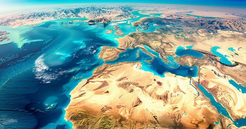
The Middle East spans parts of Western Asia and Northern Africa, covering a vast area that includes more than a dozen countries with shared histories and varied terrains. While exact definitions vary, most geographers include countries such as Saudi Arabia, Iran, Iraq, Syria, Jordan, Israel, Lebanon, Turkey, Egypt, and the Gulf states. Each of these nations plays a role in shaping the cultural and political contours of the region, but it is geography deserts, mountains, rivers, and coastlines that sets the physical stage.
The Arabian Peninsula forms the geographic heart of the region, with countries like Saudi Arabia, Yemen, Oman, and the United Arab Emirates stretching across its dry, rugged landscape. North of that lies the Fertile Crescent, a historical region stretching through Iraq, Syria, and parts of Turkey, where early civilizations thrived along the Tigris and Euphrates. Meanwhile, countries like Iran are dominated by mountain ranges and plateaus, while Egypt connects Africa and Asia through the Sinai Peninsula and controls the vital Suez Canal.
Understanding how these countries are arranged and what landscapes define them is essential for making sense of current events. Bordering seas like the Mediterranean, Red Sea, Persian Gulf, and Arabian Sea also play vital roles in trade, naval movement, and climate. The Middle East Geography Quiz challenges learners to grasp this complexity and build a solid foundation for deeper regional study.
Mountains, Deserts, and Vital Waterways
The physical geography of the Middle East is a study in contrast. Towering mountains like the Zagros in Iran and the Taurus in Turkey stand in sharp contrast to expansive deserts such as the Rub’ al Khali in Saudi Arabia, one of the largest continuous sand deserts in the world. These mountain systems influence rainfall, limit travel, and shape settlement patterns while deserts dominate the landscape and affect agriculture and population density.
Despite its arid nature, water has always been a central force in Middle Eastern life. The Nile, the Jordan, and the twin rivers of Mesopotamia the Tigris and Euphrates have supported farming civilizations for millennia. Today, water scarcity and control remain major geopolitical issues, with countries investing heavily in dams, desalination, and water-sharing agreements. Learning where these rivers flow and which countries rely on them adds critical insight into modern-day cooperation and tension.
In addition to rivers, strategic waterways shape the region’s significance on the global stage. The Strait of Hormuz, which connects the Persian Gulf to the Arabian Sea, sees nearly a fifth of global oil pass through. The Suez Canal in Egypt links the Red Sea to the Mediterranean, serving as a vital trade route between Europe and Asia. The quiz gives learners the chance to identify these choke points and understand their role in shaping both regional economies and global supply chains.
Cultural Geography and Human Landscapes
Human geography is just as vital as physical geography in understanding the Middle East. This region is home to Arabic, Persian, Turkish, Kurdish, and Hebrew-speaking peoples, along with countless ethnic and religious minorities. Cities like Jerusalem, Mecca, Baghdad, and Tehran hold immense historical, religious, and political weight. The quiz connects these cultural centers to their geographic locations, encouraging learners to view them not in isolation but as part of a complex regional system.
Religious geography is especially important in the Middle East. It’s the birthplace of the world’s three major monotheistic religions Judaism, Christianity, and Islam and remains a place of pilgrimage, prayer, and political tension. Understanding where cities like Mecca, Medina, Jerusalem, and Najaf are located helps students see how geography supports both spiritual life and state policy. The Middle East Geography Quiz reinforces this layered understanding with every question.
Modern migration patterns, refugee movements, and urban expansion also shape the geography of the Middle East today. Major cities like Cairo, Istanbul, Riyadh, and Amman are growing rapidly, often straining infrastructure and resources. Meanwhile, conflict and displacement continue to reshape the map. By learning about the physical and human geography of this region, students build not just factual knowledge but a foundation for empathy, critical thinking, and global awareness.
Quick Facts to Master Middle East Geography
- Countries in the Arabian Peninsula: Saudi Arabia, Yemen, Oman, UAE, Qatar, Bahrain, Kuwait
- Longest River: Nile River (Egypt, Sudan)
- Largest Desert: Rub’ al Khali (Saudi Arabia)
- Most Populous Country: Egypt
- Highest Mountain: Mount Damavand (Iran)
- Strategic Waterway: Strait of Hormuz (Iran, UAE, Oman)
- Oldest Capital City: Damascus, Syria
- Major Religions Originating Here: Judaism, Christianity, Islam